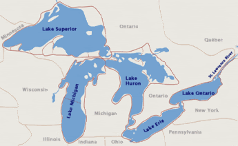
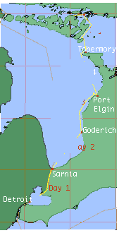
Map of the Great Lakes
Manitoulin Island is located just north of George Bay at the top of Lake Huron.
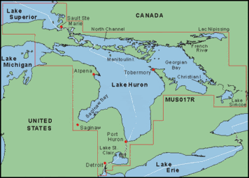
The North Channel lies just to the North of Manitoulin Island.
Most people that cruise it come from southern Lake Huron, up the shore ‘til the reach the northern tip of the Bruce peninsula and lay over in Tobermory.
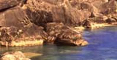
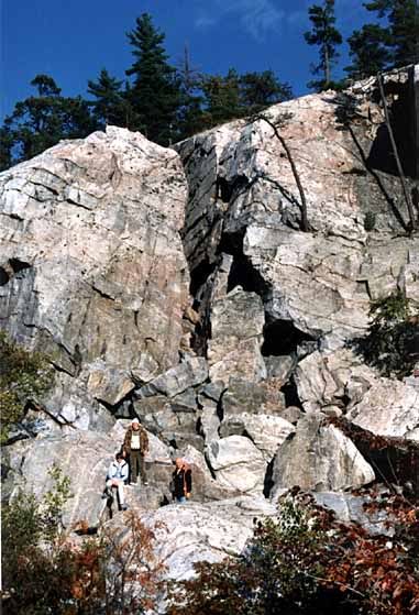
Forged from the limestone outcroppings of the Niagara Escarpment

Cliffs at Tobermory
-----
A couple of miles east of Tobermory in Georgian Bay is Flowerpot Island
Flowerpot Island is in Georgian Bay, Lake Huron.
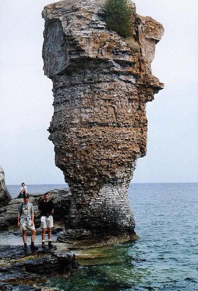
It’s part of the Fathom 5 National Park
It’s a diver’s paradise with sunken ships that provide them with interesting things underwater
-----
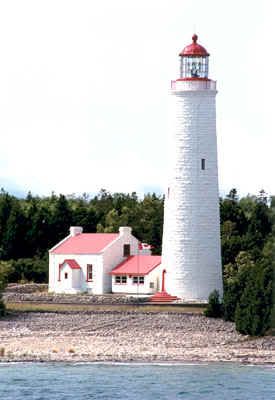
Here’s the lighthouse at the entrance to BigTub Harbour, Tobermory, Ontario
and the ferry, Chi-Cheemaun (Big Canoe, origin Ojibwe)
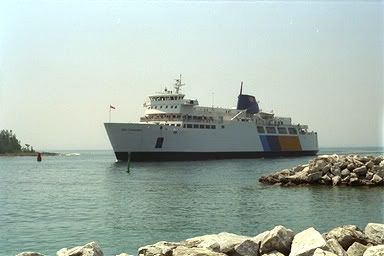
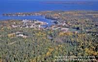
departing from Tobermory and aerial photograph of Tobermory.
From Tobermory, the ferry goes to South Baymouth, Manitoulin Island.
on the South side of Manitoulin Island. Manitoulin Island is the largest fresh water island in the world.
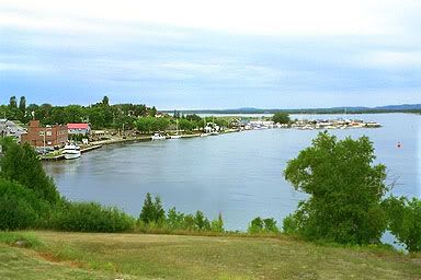
It’s usually just the ferry that puts in to South Baymouth, most boaters cruise directly to Little Current on the North side of Manitoulin Island where the entrance to the North Channel begins.
Here’s a view of where three of the lakes meet.
There’s a swing bridge at Little Current, which is the entrance to the North Channel
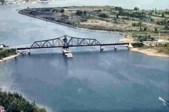
The Town of Little Current is on the left after clearing the bridge. This is where most boaters stock up for fresh groceries, supplies and sometimes top up with fuel if they need it.
-----
-----
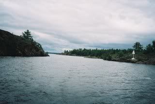
Now begins this remarkable body of water where islands are accessible by water where boaters throw their anchor in and enjoy the peace and quiet of their vacation. As long as we’ve been going there, we never tire of the grandeur of the scenery. The water is crystal clear and you can see the fish swimming when at anchor.
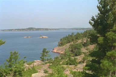
A series of deserted islands approachable only by water are set in pristine, sparkling fresh water
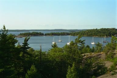
Here’s an overhead of the anchorage at Croker Island:
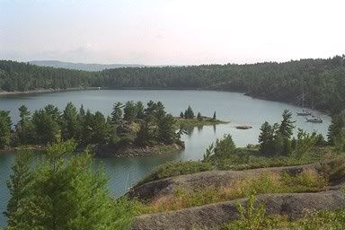
A closer look at the Inner Harbour at Croker Island:
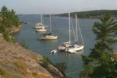
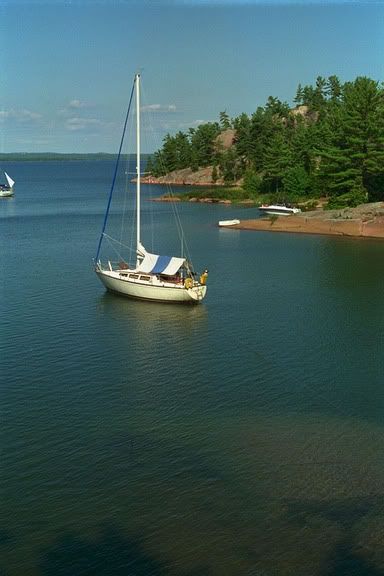
Most marinas have been left behind on the mainland and ropes are often tied to trees with anchors used off the stern. The bottom is often rocky and sometimes more than one is used.
-----
Many artists have been attracted to the North Channel. The Group of Seven are famous for the pictures they painted:
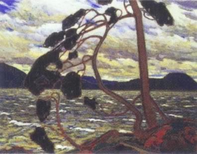
The West Wind, by Thomson:
 The Red Maple by A. Y. Jackson:
North Shore by Lawrence Stewart Harris:
Inlet, Georgian Bay by Thomson Byng:
And one of my favourite artists, Emily Carr:
The Red Maple by A. Y. Jackson:
North Shore by Lawrence Stewart Harris:
Inlet, Georgian Bay by Thomson Byng:
And one of my favourite artists, Emily Carr:
-----
Back to the islands of the North Channel. The next anchorage is in the Benjamin Islands.
Anchorage, Benjamin Islands South:
Anchorage, Benjamin Islands North
Skyline, Benjamin Islands in the distance
 Next stop: Baie Finn
:
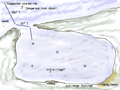
Aerial view of the Baie Finn Pool:
To the best of my knowledge, it is the only inland fjord in the world. The pool at the end is approximately 7 miles long and 100-150 yards wide in the bay. The marked channel into it is very narrow, with mountains at both sides and about 8 miles long.
The anchorages in the pool are breathtaking. Mountains all around and completely sheltered from storms. Most people do have either an inflatable boat or a small tender they tow behind.
White granite rocks that line the channel:
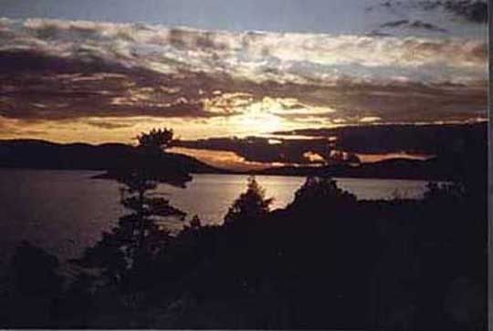
Sunset, Baie Finn
-----
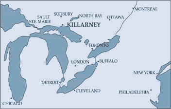
Next stop, map of the location of the Village of Killarney on the mainland of Northern Ontario
This is one of our favourite villages. It’s a world of isolation and mystery. The town of Killarrney didn’t have any electricity ‘til 1951. With no road access until 1962, water was for many years the only route of travel for its citizens and visitors. The reason for the lack of roads was because of the rock formations that is known as the Canadian shield. The 44 mile road that was built that connected them cost more than:$2,500,000.
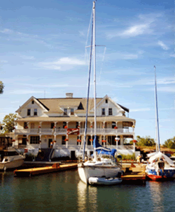
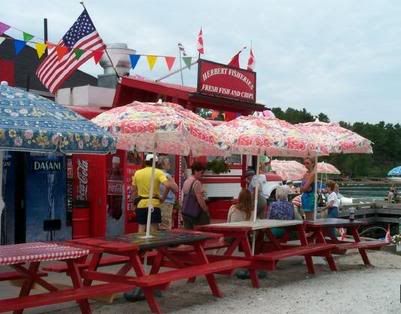
Fishing resort in the background, Killarney, Ontario:
We normally stop and pick up fresh perch for dinner.
When you’ve been a boat for a number of days, sometimes when you get off, it’s hard to get your bearings, because you are accustomed to being on the boat where the decks move up and down. So there is a tendency to make up for it by weaving about as if it still were! :)
Probably some of you who have been in the navy might be able to identify with that! Somehow, it’s much easier to adapt to a boat going up and down with the waves, than what it is to be on the land where it's still! It leads me to believe that humans really did evolve from the fish in the sea! :)
The community of Killarney was once serviced regularly by steamships that carried both passengers and freight to various locations on Georgian Bay and through the North Channel area.
It’s primarily a fishing, logging and trapping village. Almost all of their goods came first by sailing ships and later by steamers. They were extremely self-reliant and had to make due because the lake froze over cutting them off from supplies that arrived in the Spring. They did have telephones starting in 1936 so they did have contact with the outside world.
Being in that town is a step back into history. A do not miss is the little pioneer museum that houses several original sound recording of villagers complete with background scratchy sounds that lend authenticity to them. Before it was turned into a museum, it was the jail for the village! :) It’s a very small building, so they mustn’t have had too many drunks they had to toss into it.
The people who lived in that village were very independent. There were no ships, trucks or cars that delivered supplies in the winter because the lake froze over. Preserves were done up so they had fruit that lasted ‘til the next Spring. No mail was delivered over the course of the winter.
Their physical separation from the mainland often produces a cultural separation as well. Islands are always a little rustic and behind the times, it seems, from the mainlander's point of view. When travel to them is difficult, the feeling of separation increases. Manitoulin may only be located a few hundred miles due north of Detroit or Toronto, but reaching it --other than by boat-- has always been difficult.
That village wasn’t alone in being unaccessable. To reach Manitoulin from Mackinaw City in Michigan's lower peninusla, you must cross the Straits of Mackinac, travel 50 miles across Michigan's upper peninsula, cross the international border at Sault Ste. Marie, bridge the St. Mary's River, traverse 200 miles of Ontario mainland forest, crest the La Cloche mountains, and wind your way down the rocky hills to the Little Current passage. When you consider that many of the bridges along this route were not built until the mid 1950's, you can see the historical difficulty in reaching the island from the south via automobile.
-----
Onto the next stop:
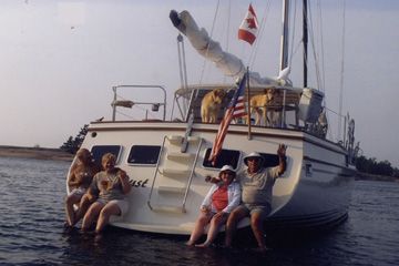
One of the most pleasant places we stayed was at Sturgeon Cove. We were guests on a 55’ Wellington that Haydn designed, built and installed the swim platform we're sitting on.
Drawing of Sturgeon Cove:
This anchorage is looking Northwest toward the narrow opening:

Prevailing winds do come from that direction and there are wonderful sandy beaches on the southeast end. The darker island in the center of the opening is High Island. Behind it are the quartzite hills of the La Cloche Mountains, the true northern coast of Lake Huron.
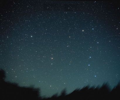
Our host is a pilot who works for GM. He flies around the world taking GM executives to their destinations. He is very knowledgeable about the stars and it gets so dark in the North Channel there is no light pollution from nearby cities. The stars against the black velvet of the skies are brilliant and you can see the entire Milky Way without the assistance of binnoculars or telescopes. He drew our attention to satellites that go by. If you’ve never experienced a really dark sky, you won’t have any idea what I’m talking about. The whole dang thing lights up brighter than any billboard – the feeling it invokes is oneness with nature. That night sky and those stars, just makes you feel so small and yet belonging to what’s up there. We really are just part of a very big universe. The Milky Way is just one of the galaxies—the effect to see it so plainly is soothing to know we’re part of much bigger picture. Did you know there are over a 100 billion stars in our Milky Way?
Big Dipper, in the Milky Way Galaxy:
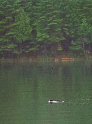
In the bay, we were treated to a family of Loons. Their evening song is a real treat. I hadn’t realized ‘til last summer that in Canada we only get to see them when they look their very best. Their distinctive markings aren’t apparent when they aren’t mating. They mate in the northern lakes, away from civilization. Listen to the charming Indian story of how the loon got its markings.
Loon Necklace
Sunset at Sturgeon Cove:
-----
Just a couple of more pictures of some other anchorages:
Little Detroit Passage, North Channel:
Meldrum Bay, Manitoulin Island, at sunset:

-----
We’ll continue to go to the North Channel because there are still hundreds of islands and anchorages to discover.
I’ll make up another diary about another wonderful place to go sailing, to anchor and get in touch with nature.
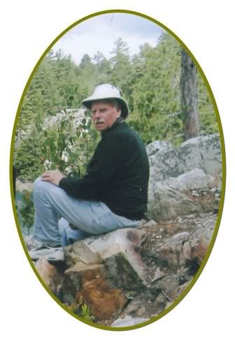
Here’s a marvellous picture I managed to get of my husband last summer.